
Use this guide for Hiking The Presidential Traverse in the White Mountains of New Hampshire. This concise guide includes all the key details you need to know before you start your trek. We also share what we wore, ate, packed, and what we would have done differently.
HIKE THE PRESIDENTIAL TRAVERSE TRAIL
What do you think about doing a hike called the “death march” that is known for the world’s worst weather and has over 150 recorded deaths? Yeah, that’s what we thought too! If you’re here, you’re a little crazy (like us), but fear not, we have you covered on how to successfully complete one of the toughest day hikes in the world – The Presidential Traverse in the White Mountains of New Hampshire.
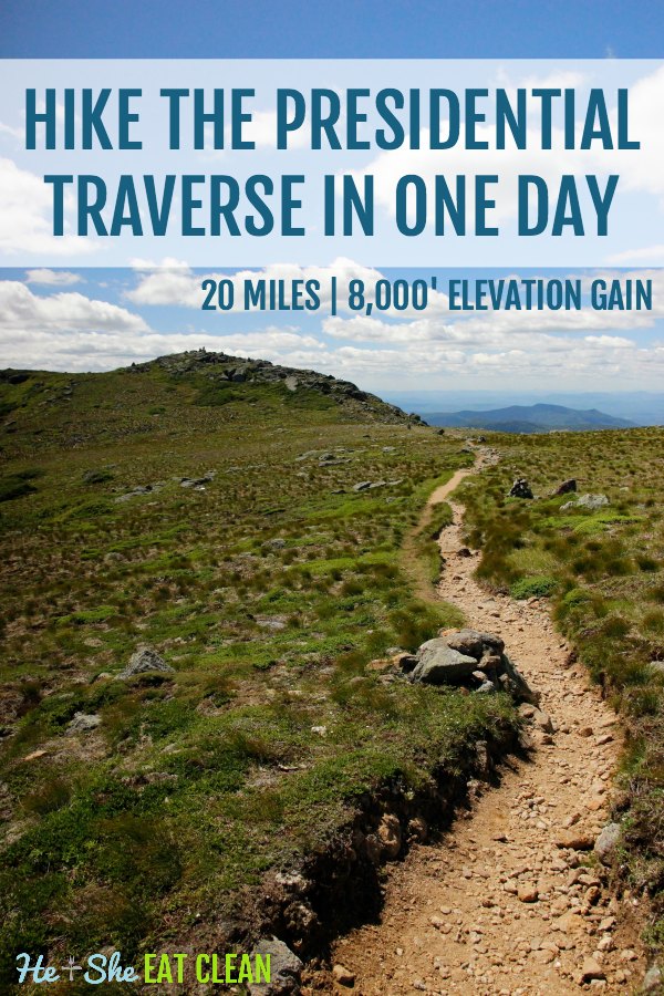
The Presidential Traverse is a hike (mostly) within the White Mountain National Forest in New Hampshire. A successful completion of the Presidential Traverse requires ascents of all the mountains named for US Presidents in the Presidential Range in one continuous hike, beginning at either the northern or southern trailheads and ending at southern and northern trailheads, respectively. One option is to hike 23 miles with 9,000+ feet of elevation gain, but you can still complete a true “traverse” by using the “shorter” trail of nearly 20 miles and 8,000+ feet of elevation gain. This hike is probably the most enjoyable when attempted over a few days but we did it in one day.
PRESIDENTAL TRAVERSE WEATHER
We did the Presidential Traverse at the end of our trip to Vermont and New Hampshire. It was during a week where the northeast was having a record heat wave, so we had to move around our hiking date to accommodate the weather. The weather in the White Mountains is definitely something that you need to consider when planning your hike. It’s always a good idea to have extra days in case you need to move around your hiking date. We recommend taking a holistic look at the weather by utilizing the following resources:
- NOAA Graphical Forecast (Mount Washington) – gives you a nice visual of temperature, wind chill/heat index, cloud cover, the probability of rain, wind speed, and direction, etc.
- Mount Washington Observatory – read the forecast discussion which is updated at least daily. This will give you a good idea on the overall weather for the entire traverse. The day we completed the hike, NOAA was spot on and MWO was a bit off saying the summit would be in and out of the clouds all day.
- Mountain Weather – not quite as reliable as the first two resources, but can be used to help reinforce the other two forecasts. The most useful tool on this link is the elevation-based temperature forecast to give you an idea on temperature extremes throughout the day.
After staying in Vermont for three days we drove to New Hampshire and did Lonesome Lake and the Franconia Ridge Loop as warm-up hikes. The temperatures were in the high 90s with high humidity but, finally, on our last full day in the area, the weather was perfect. We accomplished the Presidential Traverse on July 7, 2018.
You may also be interested in How to Get in Shape for Hiking.
TIPS TO COMPLETE THE PRESIDENTAL TRAVERSE IN ONE DAY
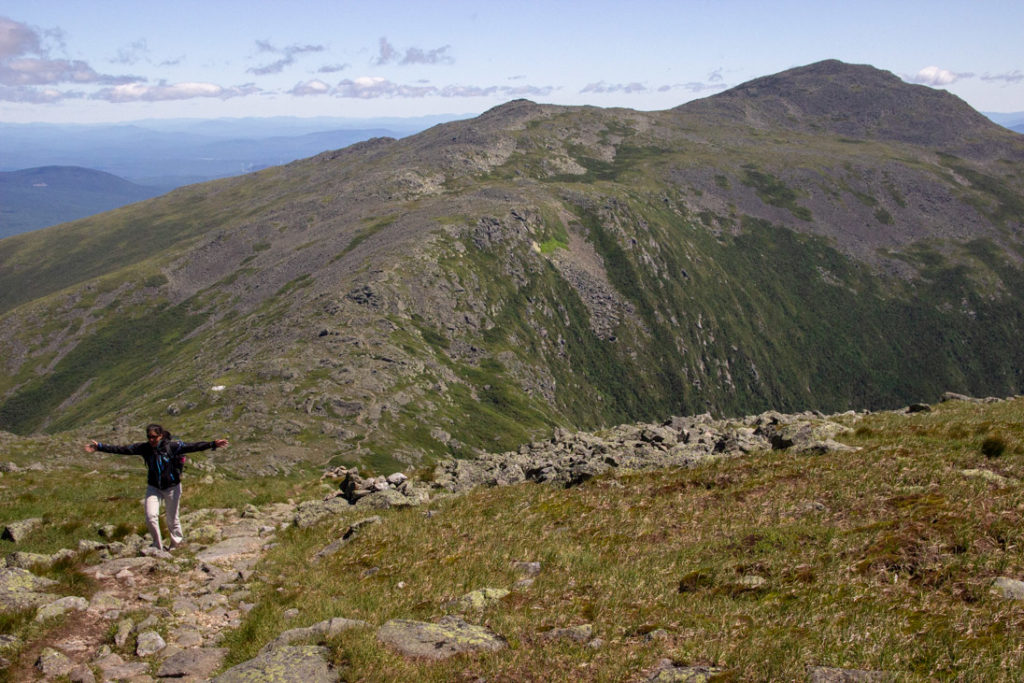
- This terrain is very different than the other areas we have hiked in. We live in Georgia and hike out west often (we’ve done Mount Whitney and the Grand Canyon in one day) so we are used to switchbacks. Be prepared because these trails are typically straight up the mountain with no switchbacks at all. The steep incline plus the rocks will make this rough on your knees if you are not used to this type of trail. Check your ego at the door – you will likely move a lot slower than normal. I would estimate 1-1.5 miles per hour.
- Start early! We started at 4 AM using headlamps from the Appalachia Trail Head parking lot. If you can’t start before 6 AM, don’t attempt the full traverse unless you have good headlamps
- Park your car at the end and arrange a taxi to take you to the trailhead. We met a couple on the trail that took us to our car but it would have been wise for us to use a taxi! It will save time when you are tired at the end of your hike.
- Another option is to hitchhike, but, again, after a long day of hiking the last thing you want to do is wait for a stranger to be nice enough to give you a ride.
- Don’t fill up your water all the way when you start. You can get water at the Madison Hut, Mount Washington, and Lake of the Clouds. This will save weight in your pack.
- Pack enough food! You can buy food at the Madison Hut and Mount Washington, but you will definitely need A LOT of calories before reaching Washington.
Check out this cool flyover video from Google Earth:
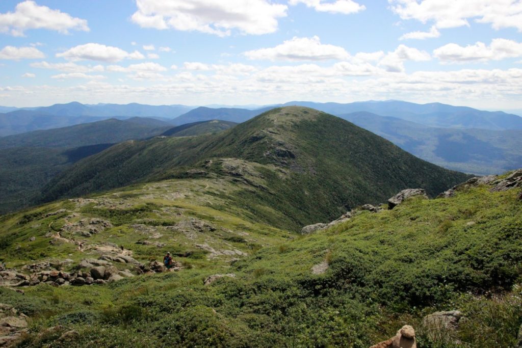
THE PRESIDENTIAL TRAVERSE
Mount Madison
- Valley Way to Madison Hut
- Summit Madison before going into the hut
- Out and back on Gulfside to the summit (you can take Watson Path up from Valley Way to avoid the out and back)
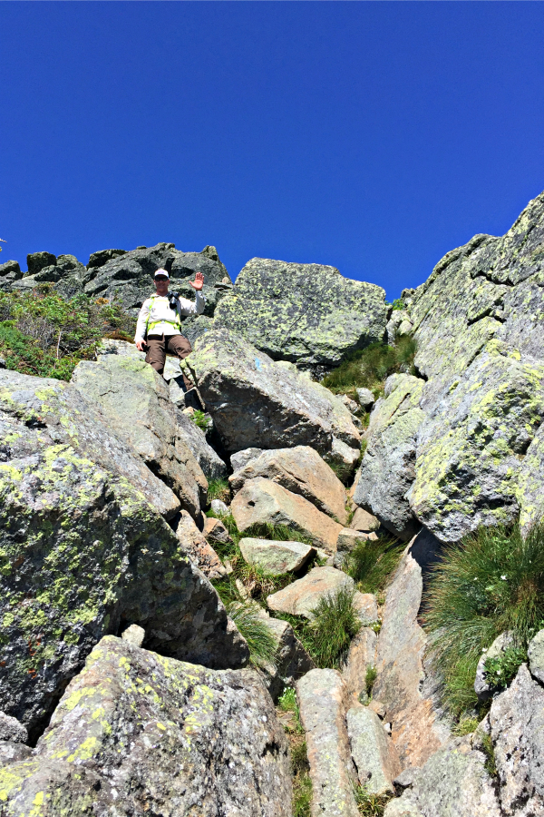
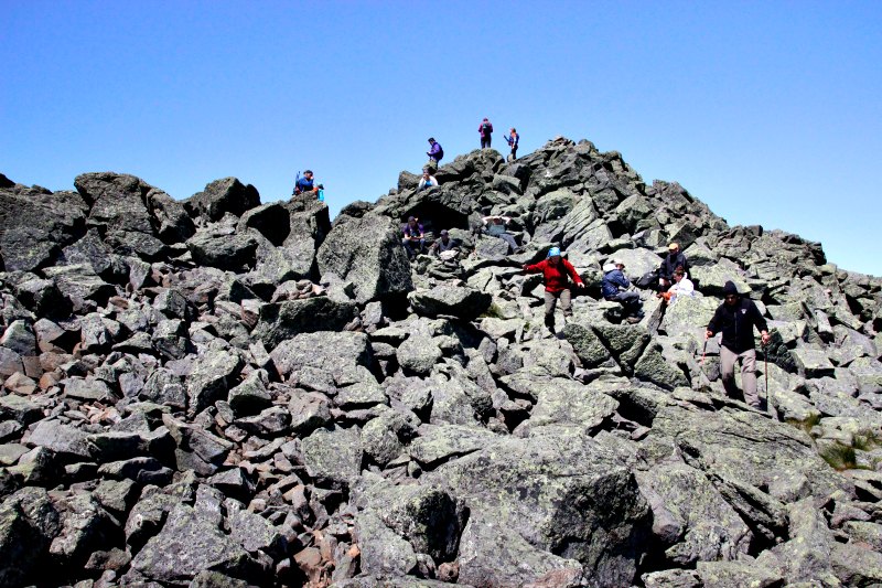
- Expect very rocky terrain once you get about 2.5 miles in and “rock hopping” to the summit on Gulfside
- Will require some light scrambling on hands and knees (more on the way down than up)
- Expect windy conditions at the summit as it’s exposed to the north, south, and east
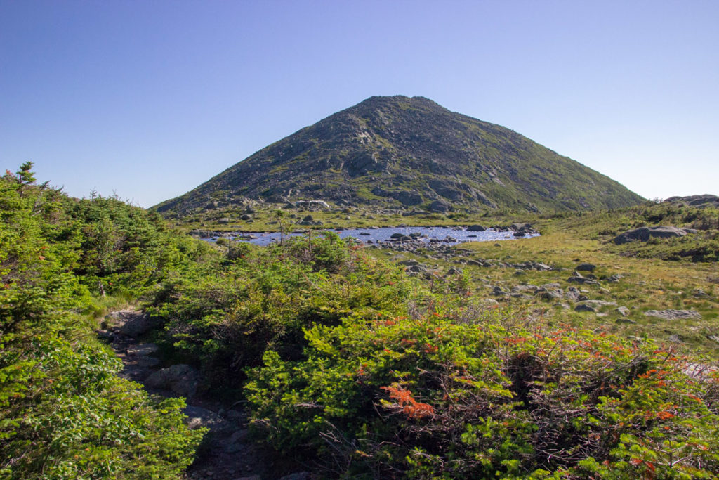
Mount Adams
- Star Lake Trail (Star Lake pictured below) to Mt Adams (this is a more difficult path – the “easier” route is Gulfside the whole way from Madison Hut, connecting to the Airline Trail to the summit)
- Very rocky terrain (more true scrambling and lots of rock-hopping; even some light non-technical climbing if you want it!)
- Also very windy as this is the 2nd highest peak in the Presidentials
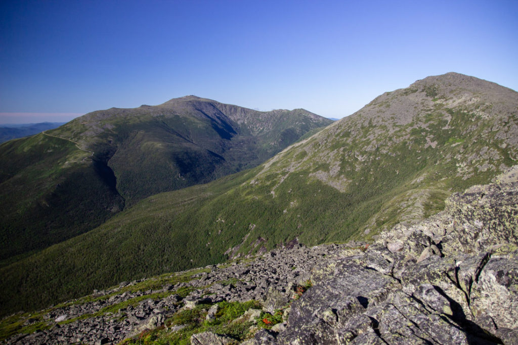
Mount Jefferson
- Back to Gulfside from Adams then summit using the Jefferson Loop trail
- Crowded – a short 2.25-mile hike on Caps Ridge trail leads to the summit, so expect no solitude here
- Rocky but not as bad as Madison and Adams
- Great views back to the northeast giving you views of your last two peaks and the Great Gulf down to the east
Mount Clay
- We skipped this one as it is not a true “Presidential peak” rather a minor summit of Mt. Washington
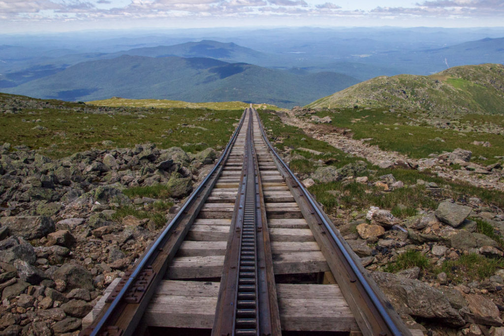
Mount Washington
- This one was a bit easier on the feet as there is more of a trail than what you had on your first three (or four) summits.
- Fewer rocks, but a long 1,300-foot climb to the top from the saddle you drop down to after Jefferson
- Relatively (operative word) easier
- Spend a little time in the Observatory Visitor Center, buy a warm meal (chili, hot dogs, pizza, soup, snacks, candy, soda, hot chocolate, etc.). There is a separate section for hikers to eat downstairs so you can avoid the crazies at the observatory.
- Refill water here
- It’s all downhill from here 😉
- Expect for three more peaks…does it ever end!?!?!
- Take Crawford Path down (hard to find from Observatory – look at the satellite towers opposite the parking lot. The trail exits the west end of the State Park area then turns northwest, west then south after the trail leaves civilization).
- Steep decline through boulder field as you descend off Washington until you reach Lake of the Clouds Hut
Mount Monroe
- Crawford Path is much nicer on the feet and knees from this point forward
- We recommend refueling at the Lake of the Clouds hut and refilling water just to ensure you have enough to get you down to Crawford Notch
- This is a very cool trail due to a little different scenery and ruggedness of the peak, but beware of the false summits here and on Eisenhower – you need to stay mentally strong at this point!
- You will take the Monroe Loop trail from Crawford Path to summit Mt Monroe and Little Monroe then back down to Crawford Path
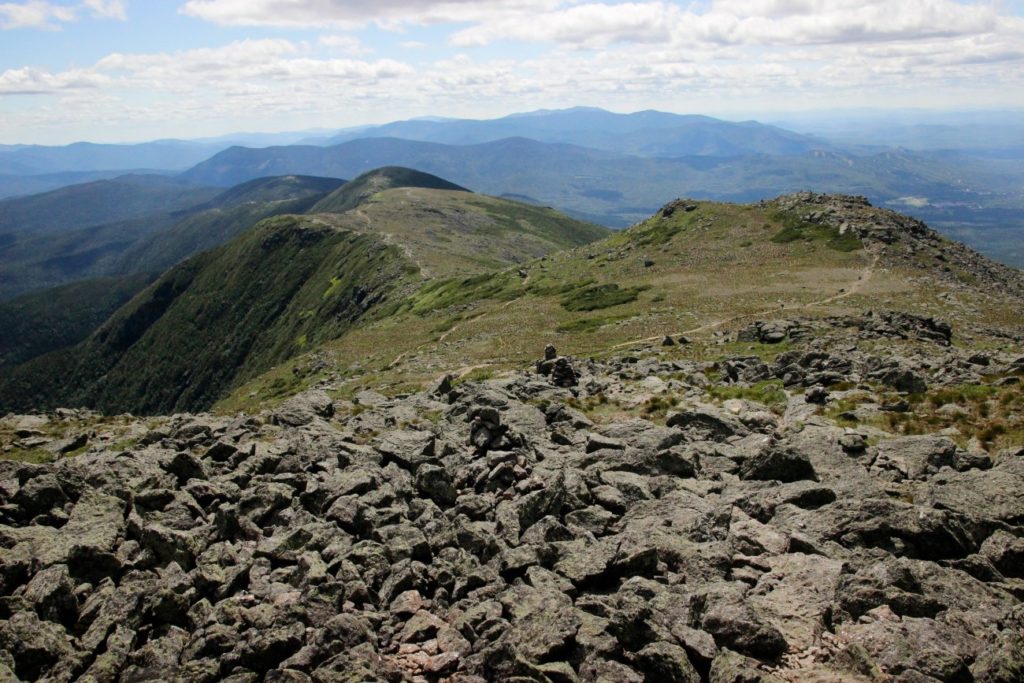
Mount Eisenhower
- Crawford Path to summit Eisenhower. Franklin (just before Eisenhower) is not part of the Presidential Traverse for obvious reasons, but it’s an easy side summit if you’re up to it!
- A very nice trail up to Eisenhower and down until you really start to lose elevation about ¼ mile past the summit then rocky again
Mount Pierce
- You will take the Webster Cliff trail from Crawford Path up to Pierce and back down (about ¼ mile) to Crawford to the southern terminus at Crawford Notch State Park
- An alternate route is to take Webster Cliff trail down to Crawford Notch by hooking up with Mizpah Cutoff, but we recommend going back down to Crawford Path
- The summit is mostly in the trees, so not as exposed as the other peaks
- It truly is all downhill from here!
EQUIPMENT NEEDED FOR THE PRESIDENTIAL TRAVERSE:
- Packs
- Whitney’s: Osprey Palea Daypack
- Scott’s: Osprey Talon 22 Backpack
- First Aid Kit
- Headlamps
- Trekking Poles
- Navigational Equipment
WHAT TO WEAR WHILE HIKING THE PRESIDENTIAL TRAVERSE:
See also: What to Wear Hiking in the Summer
Whitney
I wore a NIKE tank under my Mountain Hardwear rain jacket and pretty much kept the jacket on the whole time. It was perfect because I didn’t get too hot but the jacket helped block the wind.
- NIKE Tank
- NIKE Sports Bra
- Mountain Hardwear Rain Jacket
- Prana Monarch Convertible Pants
- Smartwool Socks
- Salomon Hiking Shoe
Scott
I started out with compression pants under my hiking pants but they made me too hot even though it was cooler in the morning. I ended up taking those off about a quarter of the way into the hike.
- Columbia Long Sleeve Shirt
- ADIDAS Wind Jacket
- Fall Raven Pants
- Balega Socks
- Salomon Trail Running Shoes
- Sun Hat
FOOD IDEAS FOR THE PRESIDENTIAL TRAVERSE
See also: What to Eat on a Day Hike
We both ate a Good Food Made Simple breakfast burrito, oatmeal, and a banana for breakfast. We ate about half of our organic chews on the first stretch before reaching Mount Madison. At Mount Madison, we both ate an RXBAR. We snacked on jerky and granola until reaching Mount Washington. At Mount Washington, we both ordered chili and bought a few other snacks. Before heading back out we also ate our nut butters. We finished the rest of our food (munk pack, walnuts, etc) during the last portion of our hike. Make sure you pack enough food!
- PROBAR BOLT Organic Energy Chews
- RXBAR Whole Food Protein Bars
- Justin’s Nut Butter Squeeze Packs
- Munk Pack Oatmeal Fruit Squeeze
- CLIF Energy Granola
- EPIC Venison Jerky
- Walnuts
LOOKING FOR MORE HIKING INSPIRATION? KEEP EXPLORING:
- How to Get in Shape for Hiking
- What to Eat While Hiking
- What to Wear Hiking in Warm Weather
- What to Wear Hiking in Cold Weather
- Hiking Etiquette 101
- Top 5 Tips for Visting National Parks
- 5 Reasons Why You Should Never Hike
- Our Trip Recaps
- 6 Tips for Outdoor Enthusiasts to Help Keep Invasive Pests from Spreading
Leave a Reply